
American River Parkway
To use the map above, click on any point. You’ll find the name and a brief description with a link to additional information. Alternatively, you can click on the square with an arrow in the upper left hand corner of the map to open a complete list of all the locations on this map. The map is easier to use if you enlarge it by clicking on the partial square in the top right portion of the map.
Fees and directions may have changed. If you have recommended changes for a location, please email them to the Web Committee.
The American River Parkway preserves approximately 5,000 acres of open space and wildlife habitat in the middle of a highly urbanized area—the parkway is five times the size of New York’s Central Park. It stretches for 29 miles along both sides of the American River from the confluence with the Sacramento River to Folsom Lake. The upper 6 miles is managed by California State Parks while the downstream 23 miles is managed by the Sacramento County Department of Regional Parks with assistance from a coalition of citizens’ groups. The Parkway is a model of civic planning and community action, though, like open land everywhere that is adjacent to urbanization, it faces threats of encroachment from numerous sources, as well as financial shortfalls.
Most access points currently require a $7 entrance fee per vehicle, but there are many sites accessible by foot, bicycle, or public transportation. A $70 annual vehicle pass ($35 for seniors 65 and over) can be purchased from the Sacramento County Department of Regional Parks.
A pocket-sized map of the parkway can be purchased on the website of the American River Parkway Foundation. A pdf of this map can be viewed here. Another valuable resource is Biking and Hiking the American River Parkway, published by the American River Natural History Association.
Birders should be mindful of bikes speeding along the trail, homeless camps, especially on the lower third of the parkway, and lush stands of poison oak throughout. Rattlesnakes are fairly common, especially on the upper half of the parkway, and mountain lions have been spotted on a few occasions. If leaving a vehicle unattended, it is wise to park in areas that get regular traffic from other park visitors; break-ins are more likely to occur in isolated lots where there are no witnesses.
Opening and closing hours change seasonally and are posted at each access. Generally, the sites are open from sunrise to sunset. The Jedediah Smith Memorial Trail (also known as the American River Bike Trail) is a paved bike route that runs the length of the parkway and continues past Lake Natoma to Beal’s Point at Folsom Lake. There are additional paved bike routes, a hiking and horse path that parallels the bike trail, and countless informal trails and park service roads to explore. Despite its proximity to over one million people, the parkway is surprisingly under-birded. There are many access points to the parkway in addition to those listed below. We hope that the following will encourage you to explore this wonderful area in Sacramento’s backyard.
Bushy Lake and Cal Expo Floodplain
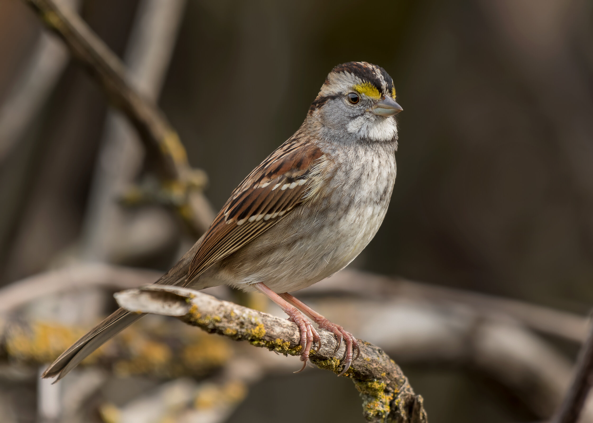
White-throated Sparrow, Image by Daniel Lee Brown
Bushy Lake is formed by a shallow basin along the American River Parkway which collects the Arden-Arcade drainage from both Chicken Ranch Slough and Strong Ranch Slough. A special dam removes the debris (tree limbs and trash) from the water before it is pumped into the river. It’s not much of a lake anymore; a better title might be Bushy Marsh. It started out as a borrow pit for a golf course that was never completed during the mid-1960s. If you look closely at the adjoining floodplain, you can see some elevated areas where the earth diggings were dumped. For many years, it was a good fishing lake, and there were many trails all along the lake. Currently, thick aquatic vegetation clogs the lake and the remaining fish are hard to find.
Birding the site: Birding can be good whether wet or dry. The best way to bird the lake is from the levee, where stretches of water can be seen through the trees.
With the Cal Expo R.V. Park on your right, walk west on the bike trail or the narrow road which leads up onto the levee; a large stream overflow basin will be on your left. Walk west on this levee heading toward the white Cal Expo tower. The lake is about half a mile from the starting point on the levee which runs along the south border of Cal Expo. Although there are a few trails closer to the lake and at its level, they have mainly been created by the homeless people who sometimes use the area. In addition, the vegetation along the lake is so thick, it is nearly impossible to see through. The best viewing is from the levee.
Birding this area can be especially good in the spring and fall because the riparian habitat around the lake, especially willows and cottonwoods, attracts many migrating warblers, vireos, flycatchers, etc., and from the levee, you are looking down on the area. The lake is good year-round for Great Egrets, Great Blue Herons, Wood Ducks, Mallards and Common Gallinules. Red-tailed Hawks, Red-shouldered Hawks and Great Horned Owls frequently nest in the area. The lake runs almost all the way to the Business 80 bridge.
There is also a slough that runs between the lake and the levee maintained by a beaver dam for the final quarter-mile before the Business 80 bridge across the American River. At the bridge, you can either retrace your steps, or walk down from the levee and follow the homeless trail along the freeway fence and across the floodplain toward the river and the American River Bike Trail. Any of the fire roads that cross the floodplain, the bike path, or the horse trail near the river will take you back to the parking lot.
This large area from the river to the levee and Business 80 back toward the R.V. park is about 400 acres. In addition to all of the birds, it harbors a great deal of wildlife such as deer, coyotes, beaver and otters. Sometimes R.V.-ers will have bird feeders that are worth checking. eBird Sightings
Directions: Bushy Lake is near the Arden Fair area of Sacramento. From downtown Sacramento, take Highway 50/Capital City Freeway 1.7 miles east of Interstate 5. Take the Capital City Freeway (Business 80) exit toward Reno. After 3.4 miles, exit the Capital City Freeway at Exposition Boulevard. In 1.1 miles, passing Cal Expo, turn right onto Ethan Way. Drive 0.4 miles south on Ethan Way to the intersection with Hurley Way. Continue straight on Ethan Way for 0.1 mi where the road ends. Park along the street or in the small lot beyond the cul-de-sac.
Joe Ceriani
Glenn Hall Park, Paradise Beach

White-tailed Kite, Image by Daniel Lee Brown
Notice: Bank protection levee work, removing all vegetation along the levee from the J Street Bridge to Paradise Bend (Site 2-1) is ongoing. Bird habitat occurs away from the construction area towards the water and to the west. To avoid possible dust and noise, you may wish to plan evening, weekend, or holiday visits. It is expected to be completed by 2024. For more information on this project visit the US Army Corps of Engineers Sacramento District Website.
Birding the Site: The parking area has oaks that attract Yellow-rumped Warblers and Bushtits. The shrubbery and playfield around Glenn Hall are host to Lark Sparrows, White and Golden-crowned Sparrows, and Dark-eyed Juncos in the winter; Yellow-billed Magpies occur unpredictably but year-round. Crossing the levee from the parking lot into the dry riverbed, you can follow several trails through denser willows and cottonwoods, all leading to spots at or overlooking the American River. In winter: exposed and shallow-water sandbars host large numbers of California Gulls, Ring-billed Gulls, Herring gulls, and an occasional Glaucous-winged Gull. Deeper water hosts Common Goldeneyes, and Buffleheads, along with Wood Ducks, and Common Mergansers. The levee is hard-packed but not paved, providing a place above the vegetation to view birds. The dry riverbed is uneven, with both sand and rock cobble. Vegetation is primarily the faster growing suitable flood plain vegetation Fremont’s cottonwood, sandbar willow, and ash trees; shrubs include blackberry brambles and coyote bush. Woody high-water debris piles support wrens, California Quail, Spotted, and California Towhees. Winter flooding is welcoming to birds, and if not too flooded, great for bird watching. The willow-covered sandbars and mature trees away from construction in this area are suitable for migrant flycatchers and Blue-gray Gnatcatchers and Ruby-crowned Kinglets. Resident breeding birds include wrens, towhees, and other small passerines.
Walking on the high bank to the west of the main beach, one can see a sandy bank on the north side of the river that is a perfect spot for Belted Kingfishers to burrow and nest, though no nests have yet been discovered.
The rarer migrant warblers and flycatchers occur among the willows and cottonwoods during fall and spring. After dark, one might hear Great Horned Owls and screech owls: White-tailed Kites, Red-shouldered Hawks, and Swainson’s Hawks nest in the area. In the past White-tailed Kites have overwintered in the suburban streets in dense evergreen trees descending just as the sunsets. Merlins occur in the winter. Vast numbers of crows move through the area late afternoon. eBird Sightings
Directions: Glenn Hall Park is about 10 minutes or 5.8 miles east of the interchange of Highway 50 and Interstate 5 in downtown Sacramento. Take the 65th St exit, and drive 0.4 mi north to Elvas Street and turn left. Drive 0.5 miles northwest and stay in the right lane to access J St. Bear right and drive northeasterly on J St for 0.25 miles to Carlson Drive. Make a left - north - on Carlson Ave (instead of going into Sacramento State University - a right or south side turn). Drive northerly on Carlson Dr. for 1 mile until until it dead-ends into the parking lot. The main beach is straight east and slightly south from the parking lot. It is nice to make a loop from the main beach, west up along the bank, and back around to the levee and the parking lot. The parking lot is free but locked at dark. Street parking is available.
Sally Walters
California State University, Sacramento
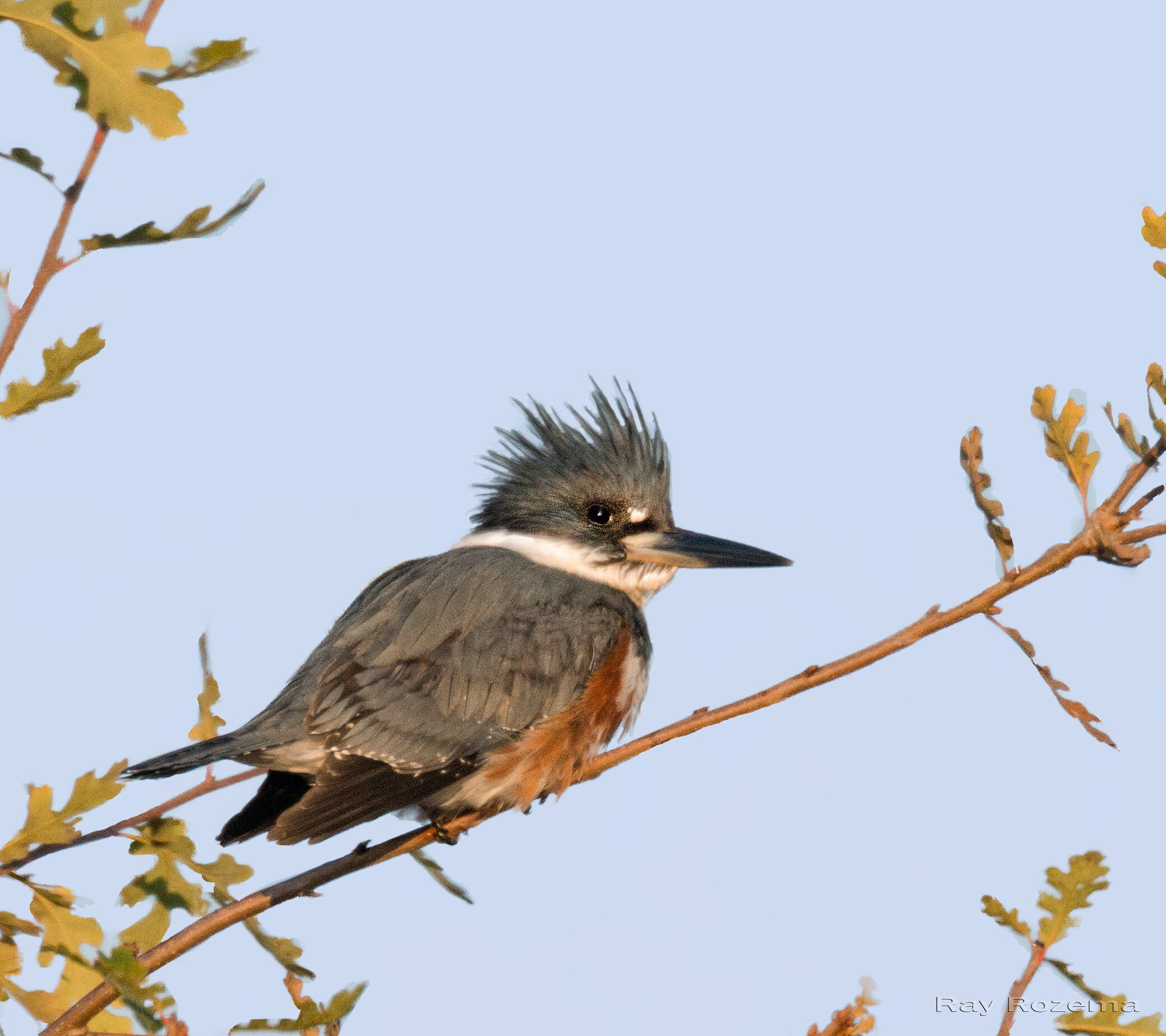
Belted Kingfisher, Image by Ray Rozema
The campus and adjacent 1.3-mile section of the American River Parkway from the Guy West footbridge east to about a half-mile past the Howe Avenue bridge are typical examples of disturbed, “modern”, streamside woodlands. The campus has large expanses of well-cared-for lawn with many hedges, planters, mature introduced trees and, near the northwest corner of the campus, a large arboretum. The parkway has few remaining large cottonwoods and willows, but there are many small willows and tangled berry vines and open savannah populated by introduced annual grasses, as well as native annuals and perennials. Note: Ongoing vegetation removal work (in 2023) by the Army Corps of Engineers has removed much of these plants in this area, especially on the lower slopes of the riverbanks.
Birding the site: In winter, look for Dark-eyed Juncos, crowned sparrows, Yellow-rumped and Orange-crowned Warblers, Ruby-crowned Kinglet, Cedar Waxwing, Red-breasted Sapsucker, Northern Flicker, Downy Woodpecker, and Hermit Thrush in all areas. An American Redstart was found as a winter vagrant in the eucalyptus trees along the west margin of the campus. Irruptive species such as Purple Finch, Evening Grosbeak, Pine Siskin and Varied Thrush can be present, but are not seen annually. Belted Kingfisher, California and Spotted Towhees, Fox and Lincoln Sparrows, Black Phoebe and Bewick’s Wren are among the species typically found on the parkway. Just downstream from the campus and the J Street bridge is a large gravel bar frequented by California Gulls and other species that fly up and down the river. Pied-billed Grebe, Common Goldeneye and Common Merganser are seen on the river.
In spring, look for migrants such as Townsend’s, Hermit, Black-throated Gray, MacGillivray’s, Nashville, Wilson’s and Yellow Warblers, Warbling and Cassin’s Vireos, Western Kingbird, Western Wood-Pewee, Western Tanager, Black-chinned and Rufous Hummingbirds, and Black-headed Grosbeak throughout the area. Watch for Cliff and Barn Swallows near the Howe Avenue bridge in spring and summer.
The year-round residents include Red-shouldered Hawk, White-throated Swift, American Kestrel, White-tailed Kite, Green Heron, California Quail, Western Screech-Owl, Great Horned Owl, Anna’s Hummingbird, Nuttall’s Woodpecker, Yellow-billed Magpie and Oak Titmouse. eBird Sightings
Directions: From downtown Sacramento, take Highway 50 east for 5.3 miles from Interstate 5 and exit at Howe Avenue. Stay right at the first ramp and follow the signs to California State University, Sacramento (variously signed as “CSUS” and “Sacramento State”). Turn left at the light onto College Town Drive, then right onto State University Drive.
After you turn on State University Drive, there are several parking lots along the way to Guy West Bridge. These require parking permits that can be purchased at permit machines located in these lots. On the CSU website (Visitor Information | Sacramento State) under “Campus Map”, you can obtain a campus parking map, costs, and real-time information on parking lot space availability.
Mike Lippsmeyer
Howe and Watt Avenue Accesses
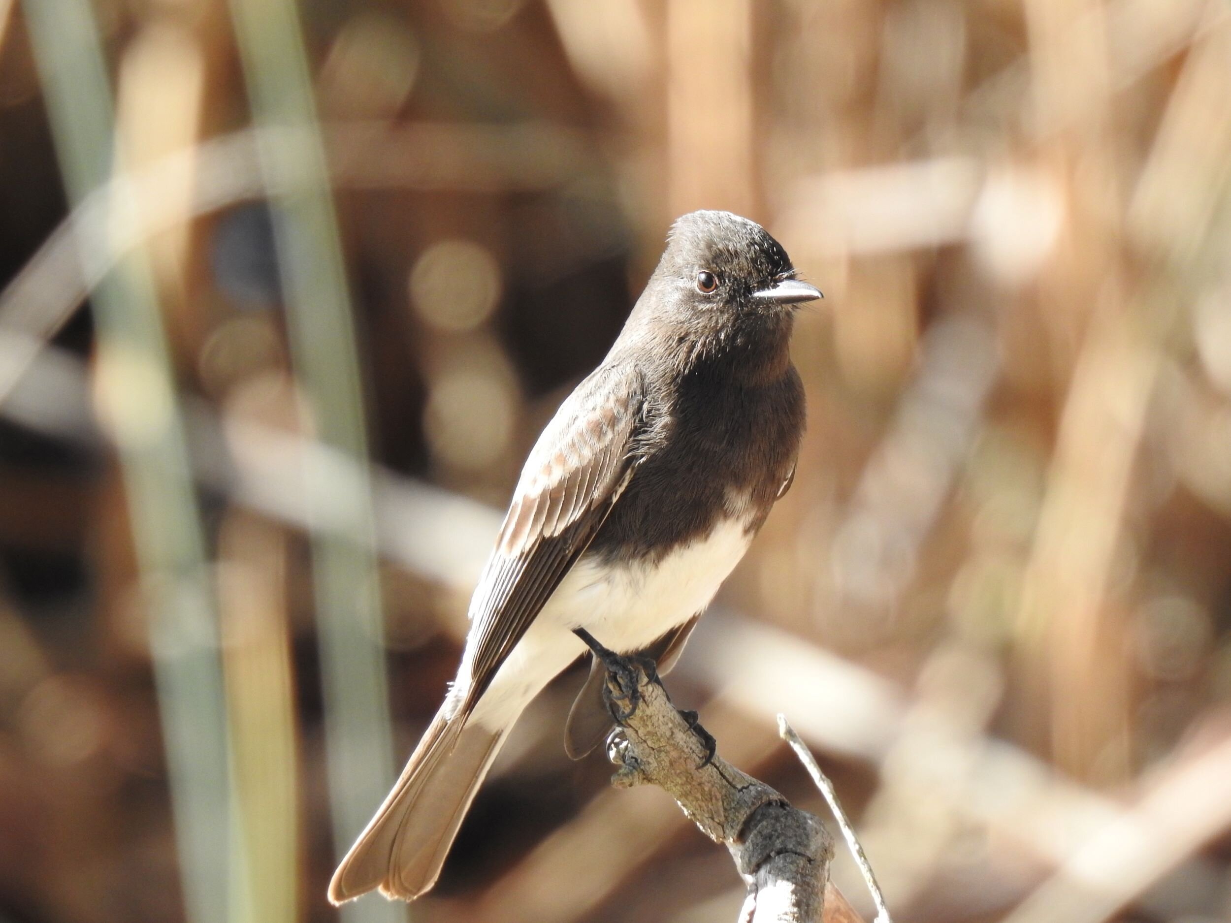
Black Phoebe , Image by Mary Forrestal
These two accesses are only a mile and a half apart and are connected by a paved bike trail as well as informal trails through the riparian forest. This is a relatively narrow section of the parkway; but there are nice stands of cottonwoods with native understory and flooded backwaters.
Birding the sites: From the parking lot at the Howe access, you can walk downstream toward California State University, Sacramento, or upstream toward Watt Avenue. Following a service road downstream under the Howe Avenue bridge, you will come to a stand of cottonwoods and an isolated pond where you may find Wood Ducks. From the Watt Avenue access, there is a particularly nice stand of cottonwoods with an understory of Santa Barbara sedge. Informal trails provide access to the forest; this is a good area in winter for sparrows and wrens. During spring and fall migration, look for warblers, vireos and flycatchers in the oaks, willows, and cottonwoods. Between the two accesses, there are several spots where the bike trail overlooks flooded backwaters below. These are good sites to see Wood Ducks, Belted Kingfishers, Green Herons, and Black Phoebes. eBird Sightings - Howe Ave, Watt Ave
Directions: From downtown Sacramento, take Highway 50 east for 5.3 miles from Interstate 5 and exit at Howe Avenue. Turn left (north) on Howe Avenue, then veer right onto La Riviera Drive just before reaching the Howe Avenue bridge. At the stoplight, go straight into the Howe Ave Access parking area. Follow the road over the levee and down to the parking lot. There is a permit machine located at the entrance to the lot.
Western Bluebird, Image by Larry Hickey
For the Watt Avenue access, take Highway 50 east for 7.0 miles from Interstate 5, and take the Watt Avenue exit north. Veer right onto La Riviera Drive just before reaching the Watt Avenue bridge. Turn left at the stop light, driving west on La Riviera for only 75 yards, and before reaching the Watt Ave bridge, make a right turn into the Watt Avenue access. There is a parking permit machine located on the right just before you go over the levee. Follow the road over the levee and down to the parking area.
The entrance fee is currently $7 per vehicle (or a $70 annual pass).
Gristmill Recreation Area
Lark Sparrow, Image by Mary Forrestal
An amazing number of rarities have been found here: Eastern Wood-Pewee, Red-eyed Vireo, Tennessee Warbler, Northern Parula, Chestnut-sided Warbler, Blackburnian Warbler, Bay-breasted Warbler, Blackpoll Warbler, Black-and-white Warbler, Hooded Warbler, and Rose-breasted Grosbeak. Reichmuth Park and Babel Slough are among the very few other small sites in the Sacramento area with a similar track record. Jeri Langham and his cadre of friends and students scour it, sometimes several times a day, during migration. Gristmill is big enough to attract and hold interesting birds, but small enough and open enough to allow for good coverage.
Birding the site: From the parking area, there are informal trails heading both upstream and downstream. Heading upstream near the river, the trail overlooks a bluff with nesting Northern Rough-winged Swallows. There are often many waterbirds visible on the large pond on the north side of the river (William B. Pond Recreation Area). Access extends for only about a quarter-mile in this direction, but it can be quite productive, and you can make a loop by returning on a different trail farther from the river. Heading downstream from the parking area, an informal trail goes through nice stands of willows and cottonwoods. These give way to stands of non-native black locust and some non-native elm. Alders and willows line the riverbank. There are several spots with open views of the river, and Barrow’s Goldeneyes are sometimes found among the Common Goldeneyes and Common Mergansers.
The parkway narrows shortly after crossing the Mayhew Drain, about one mile downstream from the parking area, though you may continue all the way to the Watt access, over two miles from the Gristmill access. A few large oaks often harbor Black-throated Gray Warblers, among other species, during spring and fall, and occasionally they overwinter here. Larchmont Park, a quarter-mile downstream of the Mayhew Drain, just outside of the levee, has hosted a Red-naped Sapsucker and Sacramento County’s only Cape May Warbler. Yellow-billed Magpies, Western Bluebirds, and Lark Sparrows are often seen here.
eBird Sightings - Gristmill, Larchmont
Directions: From downtown Sacramento, take Highway 50 east for 9.5 miles from Interstate 5. Exit at Bradshaw Road and go north (left) to Folsom Boulevard. Turn left on Folsom Boulevard, and then right onto Butterfield Way. Drive northwesterly for 0.17 miles and turn right on Linda Rio Drive. Go 0.35 mi northerly and turn right on Mira Del Rio Drive. In about 50 yards, turn left into Gristmill Recreation Area. The entrance fee is currently $7 per vehicle (or a $70 annual pass). You may also park along Mira Del Rio Drive and walk into the park.
Chris Conard
William B. Pond Recreation Area
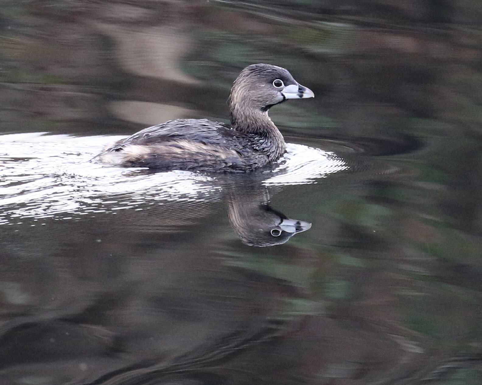
Pied-billed Grebe, Image by Chris Conard
This area is located on the north bank of the American River, bordered on the east and south by the river and on the north by a man-made levee. The habitat consists mostly of riparian woodlands found adjacent to the river and dominated by Fremont cottonwood, white alder, California sycamore, California black walnut, and several willow species. A large pond is located toward the southern edge of the area, with a large expanse of open habitat at the center. A developed park generally runs through the northern part of the area separated from the natural areas by the bicycle trail with a stand of eucalyptus trees bordering the levee. William B. Pond Recreation Area supports a diverse set of conditions with a good variety of both plant and animal life. Visitors can take a variety of trails throughout the area to search for wildlife.
Birding the site: On fast flowing water where riffles are present, look for Common Goldeneye and Common Merganser. On quiet waters look for Pied-billed Grebe, Double-crested Cormorant, Canada Goose and Mallard. Along the shoreline look for Great Blue Heron, Great Egret, Snowy Egret, Green Heron, Killdeer, Greater Yellowlegs and Spotted Sandpiper. Watch for Osprey perched on dead snags or Black Phoebe fly-catching low over the river. Listen for the rattle call of the Belted Kingfisher as it forages for fish in the river.
The ponds within William B. Pond Recreation Area are home to Pied-billed Grebe, Canada Goose, Mallard, Wood Duck, Double-crested Cormorant, Green Heron and, during the winter, American Coot. A patient observer may locate beaver in the early morning or late evening or muskrat and river otter during the day. There are several beaver lodges located against the banks of the river, as well as in the ponds. A Great Blue Heron and Great Egret nesting rookery is located east of the large pond with a lot of activity being observed between March and May.
From October through April, heavy concentrations of Turkey Vulture, Herring Gull, California Gull and Ring-billed Gull can be observed on gravel bars near riffles where salmon have died after their struggle to reach their breeding grounds. In addition, an observer may see Forster’s Terns in April and May. Cliff Swallows build gourd-like nests of mud on the bicycle bridge that spans the American River.
Sandy banks and cliffs along the river’s edge make good nesting holes for Belted Kingfisher and Northern Rough-winged Swallow. In the riparian corridor along the river’s edge, look for Red-shouldered Hawk and Cooper’s Hawk, Anna’s Hummingbird, Nuttall’s Woodpecker and Downy Woodpecker, Ash-throated Flycatcher, Black Phoebe, Oak Titmouse, White-breasted Nuthatch, Bushtit, Bewick’s Wren, and House Wren, California Scrub-Jay, Hermit Thrush, Spotted Towhee, and, in winter, Yellow-rumped Warbler, Fox Sparrow, and Lincoln’s Sparrow. Watch for western gray squirrel in the Fremont cottonwoods, California black walnut and the scattered valley oak and interior live oak of the riparian woodlands, as well as black-tailed deer in the understory near blackberry brambles.
In the open areas and the edges of woodlands, look for Turkey Vulture, White-tailed Kite, American Kestrel, Mourning Dove, Western Kingbird, Western Bluebird, California Towhee, both Lesser and American Goldfinch, as well as desert cottontail and black-tailed jackrabbit. Western Bluebird, American Crow, Yellow-billed Magpie, and House Finch are located in the developed park as well as western gray squirrel and eastern fox squirrel. eBird Sightings
You can read more about the accessible features of this locations on our Accessible Birding page.
William B. Pond Recreation Area Trail Map
Directions: From downtown Sacramento, take Highway 50 east for 7.0 miles from Interstate 5, and take the Watt Avenue exit north. Proceed 1.6 miles north to Fair Oaks Boulevard and head east for 2.5 miles to Arden Way. Turn right and go 0.7 mile to the entrance and fee station. The American River Bike Trail crosses from River Bend Park (formerly C.M. Goethe Park) on the south side via a bridge and generally runs through the northern edges of the area before turning southwest toward the large pond and then downriver toward Watt Avenue. The entrance fee is currently $7 per vehicle (or a $70 annual pass).
Dave Johnson
River Bend Park

Red-shouldered Hawk, Image by Craig Swolgaard
This area is located on the south bank of the American River, bordered on the west and north by the river and on the east and south by a man-made levee. The habitat in the center and northern part of the park consists mostly of interior live oak, valley oak, and California black walnut; whereas, along the west side in the floodplain area, Fremont cottonwood, California black walnut, white alder, and several willow species are dominant. A large expanse of open area is found along the center and the eastern side. Several large gray pines are located in the picnic area and a stand of eucalyptus trees is present just east of where the bicycle trail bisects the main access road into the area. The park has a variety of habitats to offer the visitor with trails throughout the park that visitors can take to look for wildlife and plants.
Birding the site: Along the American River, look for Common Goldeneye, Double-crested Cormorant, Canada Goose, Mallard, and Common Merganser. Great Blue Heron, Great Egret, Snowy Egret, Green Heron, Killdeer, Greater Yellowlegs, and Spotted Sandpiper can be found along the gravel shorelines of the floodplain. Pied-billed Grebe, Wood Duck, Mallard, and Green Heron are found in the quiet, sheltered stretches of the river. Look for Belted Kingfisher, Black Phoebe, and Northern Rough-winged Swallows along the edges of the river.
In the riparian woodlands, watch for Red-shouldered Hawk, California Quail, Anna’s Hummingbird, Nuttall’s Woodpecker, Downy Woodpecker, Northern Flicker, Ash-throated Flycatcher, Tree Swallow, Oak Titmouse, Bushtit, Bewick’s Wren, House Wren, Hermit Thrush, Orange-crowned Warbler, Spotted Towhee, Fox Sparrow, Song Sparrow, and Lincoln’s Sparrow. Black-tailed deer are found where the understory consists mostly of blackberry brambles.
In the oak woodlands, watch for Red-shouldered Hawk and Cooper’s Hawk, Wild Turkey, Mourning Dove, Great Horned Owl, Acorn Woodpecker, Nuttall’s Woodpecker, Western Wood Pewee, Ash- throated Flycatcher, Tree Swallow, California Scrub-Jay, Oak Titmouse, Bushtit, White-breasted Nuthatch, Bewick’s Wren, House Wren, Ruby-crowned Kinglet, Hutton’s Vireo, Yellow-rumped Warbler, Spotted Towhee, Dark-eyed Junco, and House Finch. Western gray squirrel, eastern fox squirrel, and black-tailed deer may be found throughout the woodlands.
In the open areas and the edges of the woodlands, watch overhead for Turkey Vulture, White-tailed Kite, Red-tailed Hawk, and American Kestrel. Lower down, look for Western Kingbird, Black-chinned Hummingbird, Mourning Dove, California Towhee, White-crowned Sparrow, and Golden-crowned Sparrow. California ground squirrel, black-tailed jackrabbit, and desert cottontail are often found feeding around the shrubs and smaller brush. Coyotes can be found during the day in the open areas, especially in the eastern part of the park.
Below the American River Bike Trail bridge, look for the gourd-shaped mud nests of the Cliff Swallow. Downstream from the bridge, scan the gravel bars for Turkey Vulture, Herring Gull, California Gull, Ring-billed Gull, especially during the salmon runs (feeding on dead salmon), Greater Yellowlegs, Spotted Sandpiper, and Killdeer. Forster’s Terns are present here during April and May. eBird Sightings
Directions: From downtown Sacramento, take Highway 50 east for 9.5 miles from Interstate 5. Exit at Bradshaw Road and go north (left) to Folsom Boulevard. Turn right and go approximately one mile to Rod Beaudry Drive and turn left, heading north, to the park entry fee station. The American River Bike Trail crosses from William B. Pond Recreation Area via a bridge and runs generally through the southern edge of the area, turns north and proceeds east along the American River toward Rossmoor Bar Park. The entrance fee is currently $7 per vehicle (or a $70 annual pass).
Dave Johnson
Effie Yeaw Nature Center at Ancil Hoffman Park
Acorn Woodpecker, Image by Daniel Lee Brown
More than 70 acres of riparian woodland adjacent the Effie Yeaw Nature Center (EYNC) have been preserved as a nature study area within the American River Parkway. Ancil Hoffman Park and the Nature Center are part of the annual American River Natural History Association (ARNHA) December Wildlife Count, and the Bird and Breakfast events in March. Typically 50-55 bird species are seen.
The site includes oak woodlands, grasslands, a pond and access to the river. Marked trails make exploring easy and accessible. The trails at EYNC are open daily from dawn to dusk. Visit the Effie Yeaw Nature Center website for current hours and information. When open, the Nature Center offers exhibits and information about the river and its wildlife, besides the practical advantages of rest rooms and drinking fountains. If you visit when the center is open, you may wish to pick up a map to the trails. Please remember to stay on the trails. You may also purchase field guides and checklists at the reception counter.
Birding the site: Because this birding spot is easy to reach and includes a variety of habitats, it is possible to sight more than 100 species during the course of a year. In the spring, migrating warblers move through the woods. The crowned sparrows return each fall, and winter brings the goldeneyes back to the river. A Merlin sometimes takes up winter residence on an old snag near the northeast end of the service road.
Some of the notable permanent species are the Wild Turkeys that feed in the grasslands, the Acorn Woodpeckers that take advantage of dead trees for acorn storage and nesting holes, both Red-shouldered Hawks and Great Horned Owls that nest here, along with the Yellow-billed Magpies in the tall oaks and cottonwoods of the woodlands. Frequently, you will find White-tailed Kites hunting rodents in the grasslands. Approaching the pond, you may find a Green Heron stalking fish in the shallows, hear the rattle of a Belted Kingfisher, see a pair of Wood Ducks or Mallards floating under the hanging vegetation at the pond’s edge.
Yellow-billed Magpie, Image by Chris Conard
California Scrub-Jays are a common sight, and a careful look in the oaks will often produce a flock of Bushtits, pairs of Oak Titmouse, Nuttall’s Woodpecker, White-breasted Nuthatch, and in winter, Ruby-crowned Kinglet. The blackberry thickets at the side of the road and along the paths shelter California Quail, Bewick’s Wren, and both Spotted and California Towhees. The star thistle patches attract both American and Lesser Goldfinches. Black Phoebes like the ponds. Anna’s Hummingbirds frequent the California fuchsia planted near the parking lot and visitor center. Western Bluebirds and Tree Swallows have nested in the snags at the edge of the meadow and have taken advantage of nesting boxes placed in the area.
Along the river’s edge, you may find Killdeer, Greater Yellowlegs, Spotted Sandpiper, the magnificent Great Blue Heron, and Great Egrets. When the salmon are spawning in the late fall, both American Crows and Turkey Vultures gather along with a variety of gulls to scavenge the dead fish. eBird Sightings
In addition to the many species of birds you may spot, you may also find deer, western gray squirrels, California ground squirrels, and see evidence of the many other mammals that live in the nature area such as striped skunks, gray foxes, coyotes, opossums, raccoons, cottontails, and jackrabbits.
The Effie Yeaw Nature Center and the surrounding area are truly rich in wildlife and are great places to introduce young and old to the natural world. Visit often.
Directions: The Effie Yeaw Nature Center is located in Ancil Hoffman Park. From downtown Sacramento, take Highway 50 east for 7.0 miles from Interstate 5, and take the Watt Avenue exit north. After 1.6 miles, turn right onto Fair Oaks Boulevard. In 4.0 miles, turn right onto Val Alstine Avenue. After 0.4 mile, turn left onto California Avenue driving north for 0.15 miles, then turn right onto Tarshes Drive. The parking area for the Nature Center is on San Lorenzo Way, a left turn off Tarshes Drive (The gate on San Lorenzo Way off Palm Avenue is an exit only). The entrance fee is currently $7 per vehicle (or a $70 annual pass). Members of ARNHA have free parking in the Nature Center parking lot.
Jo Smith; updated by Brian Gilmore
Rossmoor Bar
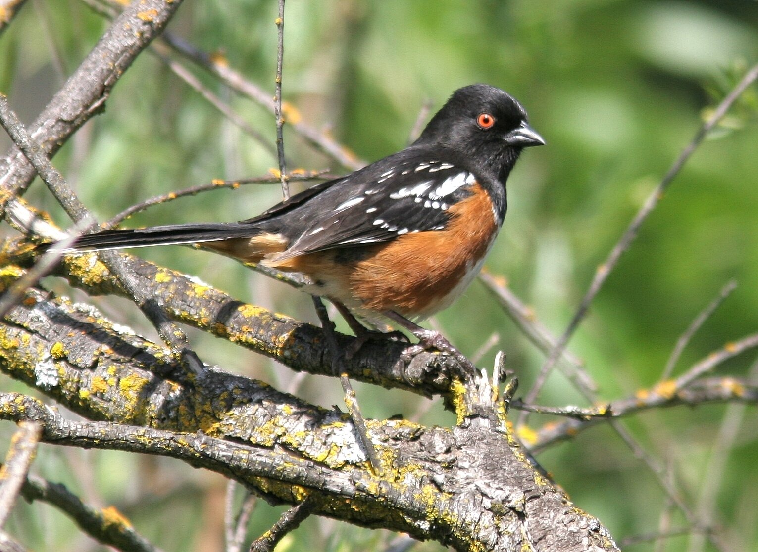
Spotted Towhee, Image by Chris Conard
Rossmoor Bar offers a similar mix of birds and habitats as described for Lower Sunrise. It is heavily impacted by dredge mining for gold along the river that occurred during the first half of the last century. Large piles of gravel and reduced topsoil have left many open areas with only pockets of vegetation. The bare soil and patches of gravel are good sites to look for reptiles.
Birding the site: On the drive into the park, you may see Wild Turkeys and black-tailed deer along the road. From the parking area, begin walking upstream on a service road. There are patches of vegetation that hold common species such as Anna’s Hummingbird, Bewick’s Wren, and Spotted Towhee. Phainopepla have also been spotted in recent years. A few large cottonwoods have managed to grow in the otherwise gravelly and hard soil; they have been known to hold raptor nests. eBird Sightings
Following the service road and informal trails, there is a lot of habitat to explore. You can continue upstream to the San Juan Rapids (see Sacramento Bar section) and beyond.
Directions: From downtown Sacramento, take Highway 50 east for 11 miles from Interstate 5, and take the Mather Field Road exit. Go north to Folsom Boulevard and turn right. In 0.4 mile, turn left on Coloma Road. In 1.6 miles, go left on Rossmoor Drive. Go all the way to the end of the road and park. The entrance fee is currently $7 per vehicle (or a $70 annual pass).
Sacramento Bar and Bannister Park

Yellow-breasted Chat, Image by Daniel Lee Brown
This is a large area on the north side of the river across from the Lower Sunrise Area that can easily satisfy a half-day of birding. There is a similar mix of habitats—cottonwood and willow riparian, interior live oak forest, and open areas with gravel tailings—but there is a wider corridor of habitat and numerous trails to get away from the crowds.
Birding the site: From the Sacramento Bar parking area, a loop of approximately two miles will cover many habitats. A bike trail connects the parking area with Bannister Park and a service road and a network of informal trails nearer the river await exploration. You can take the service road that runs along the river, eventually leading to the two sharp bends in the river at the San Juan Rapids. In this section, there are several ponds of trapped water left behind in the gravel tailings that can harbor waterbirds. A wide trail heads north along the river and connects to the bike trail just below the hill at Bannister Park. At this site, near the creek, Yellow-breasted Chats are sometimes heard in spring, and this may be one of the few sites in Sacramento County where they breed (this site may also be reached from Bannister Park by descending the hill on the bike trail and looking and listening along the creek that crosses the bike trail). You can return to the Sacramento Bar parking area via the bike trail. It is shaded by a dense stand of interior live oaks for most of the way.
From the Sacramento Bar parking area, you can walk across the river to Lower Sunrise via Jim’s Bridge just below the Sunrise Boulevard bridge.
eBird Sightings - Sacramento Bar, Bannister Park
Directions: From downtown Sacramento, take Highway 50 east for 14 miles from Interstate 5, and take the Sunrise Boulevard exit. Turn left on Sunrise, and drive north for 2.3 miles, crossing the river, to Fair Oaks Boulevard and turn left. Take an immediate left onto Pennsylvania Avenue, and follow it 0.4 mile to the parking area. For Bannister Park, travel west on Fair Oaks Boulevard 0.8 mile from Sunrise Avenue, and turn left on Bannister Road. The entrance fee is currently $7 per vehicle (or a $70 annual pass).
Chris Conard
Lower Sunrise Area
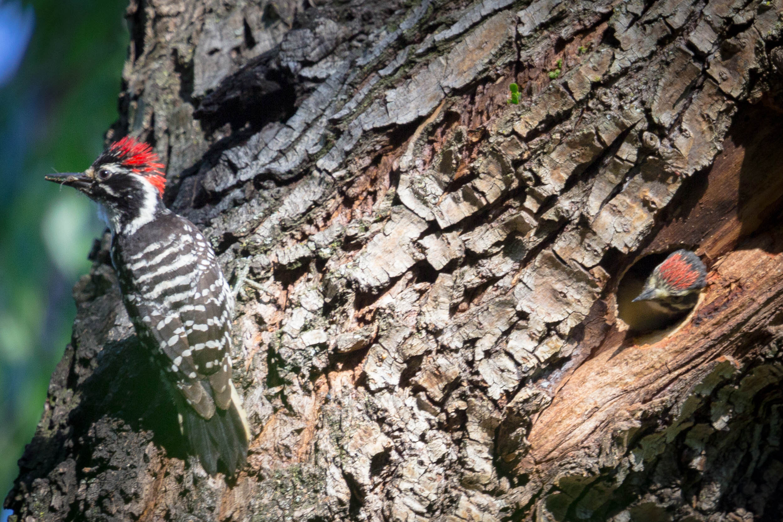
Nuttall’s Woodpecker, Image by Larry Hickey
The Lower Sunrise area is on the south side of the American River, and runs from the Sunrise Boulevard bridge downstream to the picnic area of Ambassador Park. Low bluffs overlook the river, their banks covered with blackberry, coyote bush, willow, and poison oak. Cottonwoods, live oaks, and valley oaks shade the horse trail and much of the bicycle trail. If you walk along the bicycle trail, always be aware of cyclists.
Birding the site: Colonies of Acorn Woodpeckers can be seen as well as Nuttall’s Woodpeckers and an occasional Downy Woodpecker. Oak Titmouse, Bushtits, and White-breasted Nuthatches move through the trees. Tree Swallows can be seen year-round, though there are fewer in the winter after their migrant cousins have gone south. Bewick’s Wrens, Spotted Towhees, and California Towhees are year-round residents and are joined by House Wrens in spring. In the fall and spring, migrating songbirds such as Townsend’s Warblers, Hermit Warblers, Nashville Warblers, Wilson’s Warblers, Bullock’s Orioles, and Black-headed Grosbeak may be spotted. Red-shouldered Hawks can often be heard calling and are seen year-round. Red-tailed Hawks, American Kestrels, Sharp-shinned Hawks, and Cooper’s Hawks may also be found. In November, Common Goldeneyes arrive, and if one searches through the flocks, a Barrow’s Goldeneye may be spotted. Common Mergansers are more numerous in the winter, but are present year-round. Gulls and Turkey Vultures arrive in large numbers when the salmon return to spawn. Although California Gulls, Herring Gulls, and Ring-billed Gulls are the most common species, one might also see Glaucous-winged Gulls, Thayer’s Gulls, or Short-billed Gulls. Late fall through early spring, Osprey and an occasional Bald Eagle can be seen. Black Phoebes and Belted Kingfishers forage along the river’s edge. The fall also brings both White-crowned and Golden-crowned Sparrows, along with the more elusive Lincoln’s and Fox Sparrows. Dark-eyed Juncos, Hermit Thrush, and Ruby-crowned Kinglets move through the trees and bushes. eBird Sightings
From the Lower Sunrise parking area, you can walk across the river to Sacramento Bar via Jim’s Bridge just below the Sunrise Boulevard bridge.
Directions: From downtown Sacramento, take Highway 50 east for 14 miles from Interstate 5, exit at Sunrise Boulevard, and go north for 1.5 miles. Just before the approach to the Sunrise Avenue bridge over the American River, follow the sign indicating river access to the right and continue to the entry station. About 75 feet past the entry station, the road forks. Turn left and follow the road back under the Sunrise bridge and proceed to the parking area. Lower Sunrise can also be entered from Ambassador Park. From Highway 50, take Sunrise Boulevard north for 0.8 mile and turn left on Coloma Road. Travel 0.9 mile to El Manto Drive and turn right. Continue 0.2 mile to Ambassador Drive. Turn right and drive 0.25 mi to the parking lot of Ambassador Park on the left. The entrance fee is currently $7 per vehicle (or a $70 annual pass).
Barbara Mohr
Sailor Bar
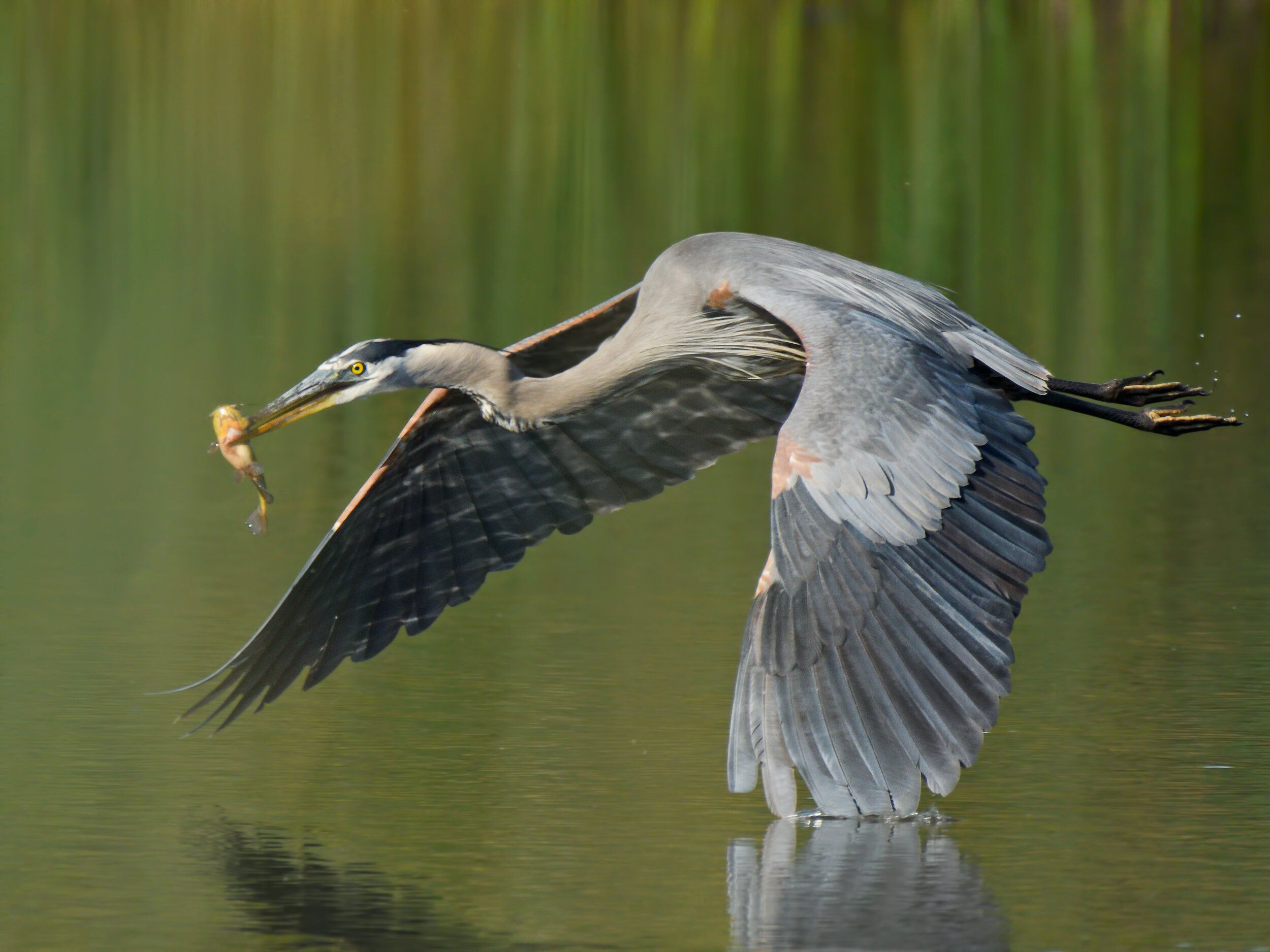
Great Blue Heron, Image by Daniel Lee Brown
Sailor Bar is on the north side of the river across from Upper Sunrise. The habitat is a mix of riparian, oak woodland, open area, and gravel tailings. Live oaks and blue oaks are the predominant trees on the hillsides, and there are stands of willow, alder, and cottonwood along the river.
Birding the site: There is a parking area down and to the right of the Illinois Avenue entrance; just north of it is a fishing pond where you can find Pied-billed Grebes and Mallards mixed in with domestic ducks. Red-winged Blackbirds inhabit the cattails in the spring and summer, and Red-shouldered Hawks frequent the area. Hutton's Vireos may be seen here. From late fall through early spring, a walk around the pond may reveal Fox Sparrows, Hermit Thrushes, or a Lincoln's Sparrow in the blackberry tangles. Song Sparrows, Spotted Towhees, and California Towhees are resident. Ruby-crowned Kinglets, Purple Finches (rare), and Yellow-rumped Warblers make the oak-covered hillsides their winter residence. In the open areas, you may see White-tailed Kites and Red-tailed Hawks. Wild Turkeys are seen occasionally in the winter, both White-crowned and Golden-crowned Sparrows, House Finches, and both Lesser and American Goldfinches feed on thistle and other seeds.
The road leads west to other parking areas by the river, and if you walk along the trails, you may find Spotted Sandpipers, Greater Yellowlegs, Great Blue Herons, and Great Egrets hunting along the water's edge. Black Phoebes, Bushtits, and Acorn Woodpeckers are seen year-round, and in the spring and summer you may see Ash-throated Flycatchers and possibly Bullock's Orioles. eBird Sightings - Fish Pond, Sailor Bar
Directions: From downtown Sacramento, take Highway 50 east for 17.5 miles from Interstate 5, and exit at Hazel Avenue. Turn left on Hazel and drive 1.3 miles north, crossing the American River, to Winding Way. Turn left and drive 0.5 miles west to Illinois Avenue. Turn left and drive southerly about 0.9 miles, to where the road ends at a parking lot adjacent the river. Watch for speed bumps. The entrance fee is currently $7 per vehicle (or a $70 annual pass).
Pete Hayes
Upper Sunrise and the Nimbus Fish Hatchery
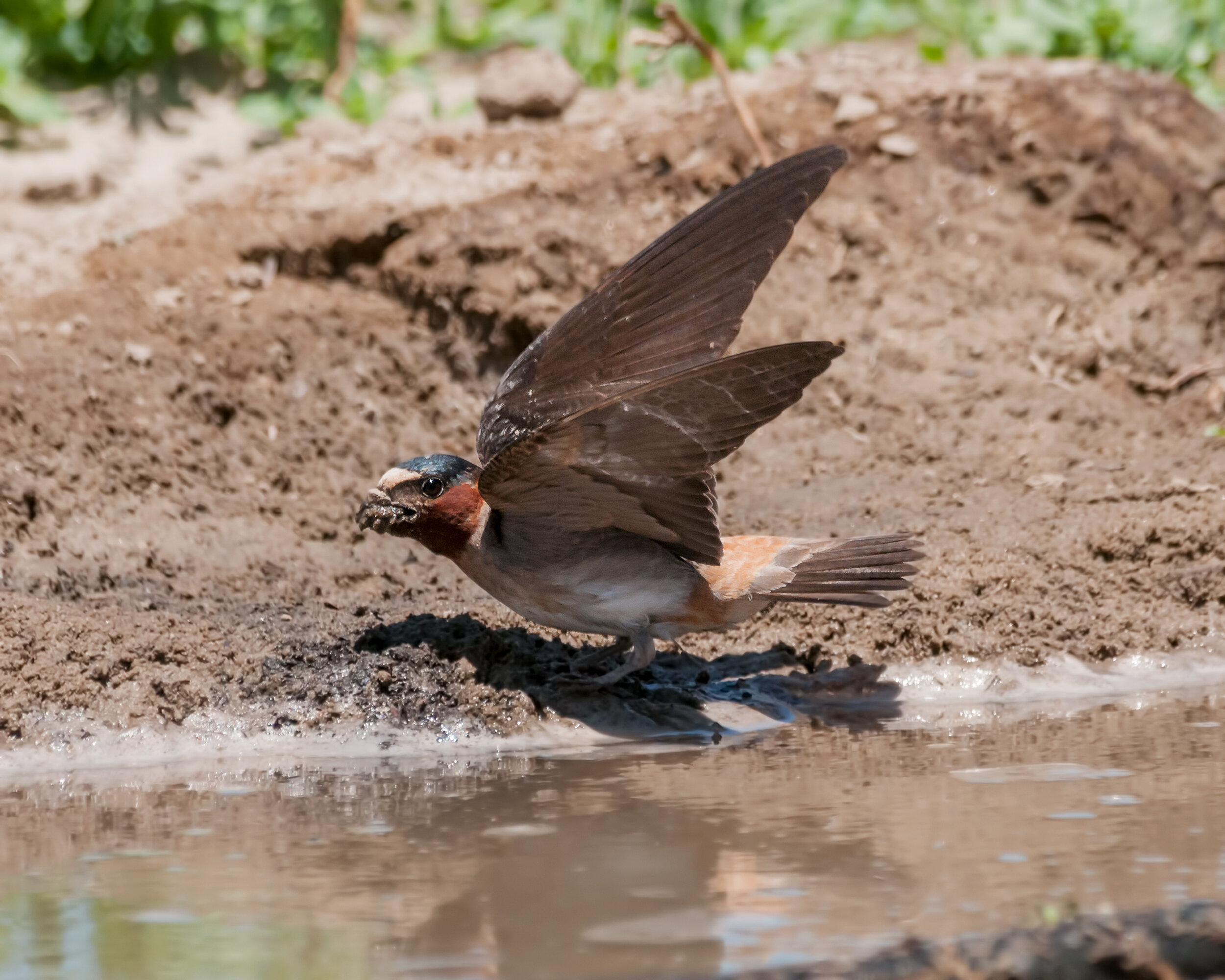
Cliff Swallow gathering mud for building its nest, Image by Daniel Lee Brown
The Upper Sunrise area goes from the east side of the Sunrise Avenue bridge upstream to the base of Nimbus Dam. The habitat is similar to Lower Sunrise, but the land rises slightly higher above the river. Shortly below the fish hatchery, one can see toyon and gray pines scattered among the oaks. This is one of the best inland sites in the state for Barrow’s Goldeneye and gull watching.
Birding the site: In the spring, California poppies, styrax with its clusters of white blossoms, and California buckeye put on a colorful display. Bush monkey flower is fairly abundant in the open areas, and Anna’s Hummingbirds can be seen sipping nectar from its orange-colored blossoms. Migrating Rufous Hummingbirds and Black-chinned Hummingbirds (spring and summer residents) may also be spotted.
White-throated Swifts can be seen year-round, and in the spring they are seen flying to and from their nests in the drain holes under the Hazel Avenue bridge. Spring also brings Cliff Swallows who build their bottle-shaped mud nests on the side of the bridge. Northern Rough-winged Swallows and an occasional Barn Swallow can be seen also. Tree Swallows are seen year-round, but are more numerous in the spring. Forster’s Terns and an occasional Caspian Tern cruise up and down the river as well as Double-crested Cormorants. Green Heron (often seen inside the hatchery enclosures), Great Egret, Snowy Egret, and Great Blue Heron can be seen along the rocky shore across the river. The riparian area along the river is home to Red-shouldered Hawk, occasional Cooper’s Hawk, Sharp-shinned Hawk, Red-tailed Hawk, and Great Horned Owl. Black Phoebe and Belted Kingfisher forage along the water’s edge. Spotted Sandpiper is often seen on the rocky shore of the river. Bewick’s Wren, Spotted Towhee, California Towhee, Oak Titmouse, and Bushtit can be seen year-round, and from fall through spring they are joined by both White-crowned and Golden-crowned Sparrows, Dark-eyed Junco, and Ruby-crowned Kinglet. Western Bluebird, Lesser Goldfinch, and American Goldfinch can be seen in the more open areas. In the fall and winter, one may see a Phainopepla perched on top of an oak tree or foraging in a cluster of mistletoe.
The main Chinook salmon run begins in October, and hundreds of gulls as well as large numbers of Turkey Vultures arrive to feed on the dying fish. This winter feast may bring in an occasional Bald Eagle. Ospreys are also often seen in winter. Flocks of Common Goldeneye and Common Merganser often have a Barrow’s Goldeneye, and occasionally, a Red-breasted Merganser among them. In 2021 - 2022 a Long-tailed Duck spent the winter among the Goldeneye.
The bluffs by the hatchery offer an excellent viewing place to watch the gulls and ducks, and a careful search through the flocks of Herring Gulls, Ring-billed Gulls, and California Gulls may reveal some less common species such as Glaucous-winged Gull, Thayer’s Gull, Short-billed Gull, and, irregularly, Western Gull. Glaucous Gulls have been found at this site, and other rarities are always possible.
From the hatchery parking area, you can walk past the fish ladder where informal trails follow the riverbank and eventually connect to the bike trail which leads to the Sunrise Access parking lots and beyond.
eBird Sightings - Upper Sunrise, Fish Hatchery
Directions: From downtown Sacramento, take Highway 50 east for 17.5 miles from Interstate 5, and exit at Hazel Avenue. For the upper end: go north on Hazel Avenue. Just before the bridge over the river, there is a traffic light at Gold Country Boulevard. Turn left and make a quick right into the entrance of the Nimbus Fish Hatchery (watch for bikes on the entrance road). There is no parking fee here, though it may be full on weekends. The hatchery has restrooms in the visitor center. Although you can stay later, the entrance to the parking lot is gated (closed) at 3 pm daily. For the lower end: follow the directions for the Lower Sunrise Area. Go past the entry station to where the road forks, and turn right. Follow the road to the parking area by the old Fair Oaks Bridge. You can walk the approximately 2.5 miles along the bike trail to the hatchery. The entrance fee is currently $7 per vehicle (or a $70 annual pass).
Barbara Mohr