San Joaquin and Solano Counties

To use the map above, click on any point. You’ll find the name and a brief description with a link to additional information. Alternatively, you can click on the square with an arrow in the upper left hand corner of the map to open a complete list of all the locations on this map. The map is easier to use if you enlarge it by clicking on the partial square in the top right portion of the map.

Fees and directions may have changed. If you have recommended changes for a location, please email them to the Web Committee.


San Joaquin County

Woodbridge Ecological Reserve (Isenberg Crane Preserve)

One of the most accessible areas for observing large numbers of Sandhill Cranes is located just south of Thornton west of Interstate 5. Several roads provide easy access to the fields where the cranes feed, rest, and dance. An ecological reserve administered by the California Department of Fish and Game is located on Woodbridge Road. Entrance to the reserve is not allowed, but excellent viewing is available from the parking area and viewing platform that overlooks the reserve. Accessibility to this site is enhanced by a raised paved viewing platform which is accessed by a ramp, handicapped parking spaces, and an accessible port-a-loo. A valid lands pass or valid fishing or hunting license is required. To purchase a valid lands pass visit CDFW’s Online License Sales and Services. Passes can be purchased at the site using a smartphone equipped with a QR code reader.

Birding the site: From October through March, many fields in this area contain Sandhill Cranes in varying numbers, with the best time for observation occurring during January, February, and March when some fields are flooded, and there are also large numbers of wintering shorebirds and waterfowl. Greatest numbers of Sandhill Cranes are usually along Woodbridge Road. If you are after a species count, give the barnyards along the road a close look. You should find House Finches, crowned sparrows, pheasants, and even a Belted Kingfisher.

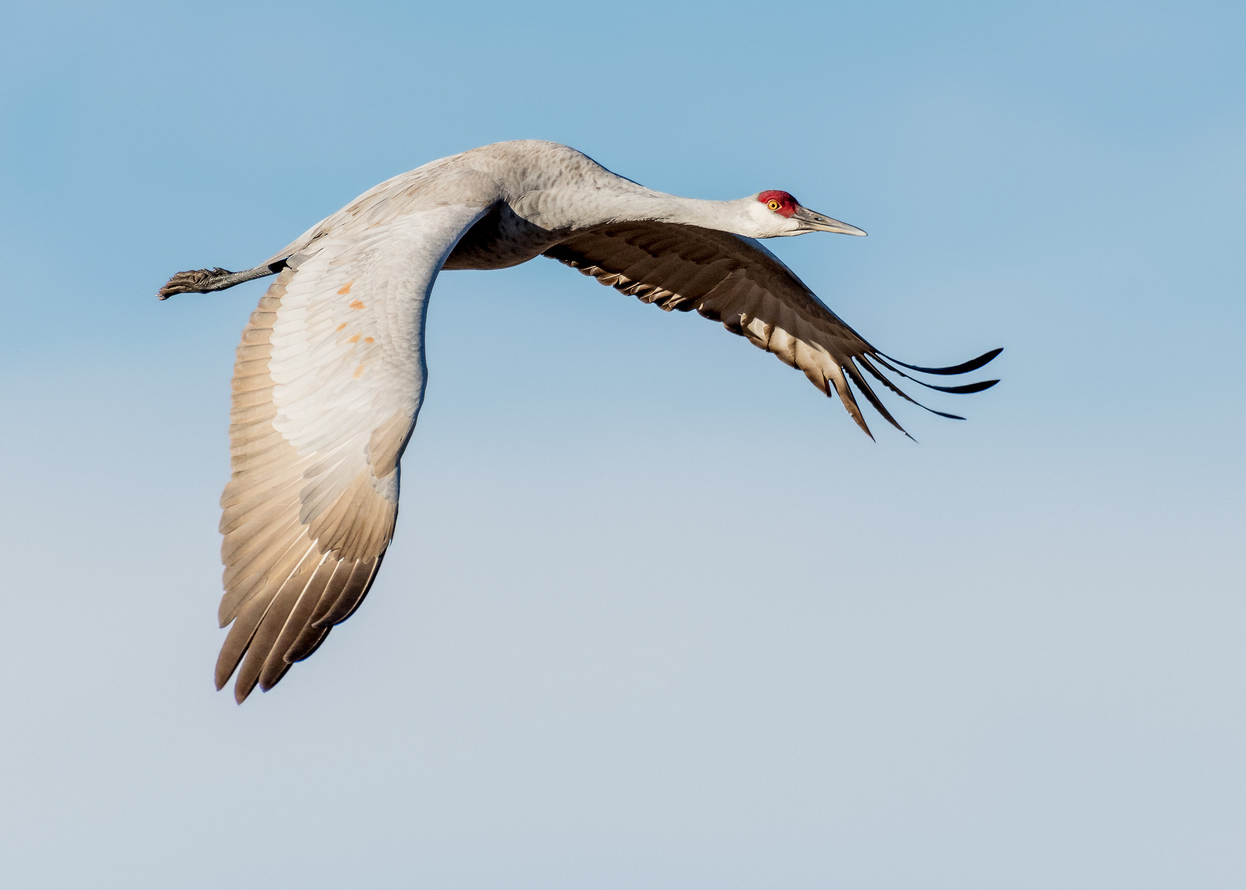
Sandhill Crane, Image by Daniel Brown

Sandhill Crane, Image by Daniel Lee Brown

Generally, the Sandhill Cranes will first be spotted off in the distance appearing like fence posts or a herd of sheep along the dikes and ditches. Sometimes you may be lucky and find them standing in small groups very near the roadside although generally, they will be further out. In the early spring you can watch them display their courting dance.

The ecological reserve is the best place for a spectacular sight at sunset as the cranes in the thousands return to this area to roost for the night. The reserve is flooded for the cranes to roost with their feet in water to discourage predators. After the hunting season is over and during the period when the fields are flooded for alkali control, there will be thousands of shorebirds, ducks, geese, and swans feeding and resting in the area. During this time, the cranes will be found standing in large groups along the levees and ditch banks.

At the west end, Woodbridge Road dead-ends at the Mokelumne River, so retrace your route back to the highway, turn left and proceed north back to Peltier Road. Turn left (west) on this road for another crane area. At Blossom Road, turn right and look for Cinnamon Teal, Common Gallinule, Pied-billed Grebes, and American Bitterns in the slough. Where Blossom Road intersects the Walnut Grove-Thornton Road, turn left (west) from Blossom onto this road and proceed 3.0 miles to the Staten Island Road and turn left. Large numbers of cranes and other waterbirds may be seen in the flooded fields. Access here is only from the public road. The end of the public road is clearly marked. There are flooded fields intermittently along the entire length of Walnut Grove- Thornton Road and, depending on the water level, they may be home to thousands of wintering shorebirds and waterfowl. The best time for viewing in this area is November through February. eBird Sightings

The only caution for many winter days is the possibility of heavy fog making it almost impossible to see cranes and other wildlife. The state offers guided tours during the height of Sandhill Crane presence. For specific dates and times, visit the California State Fish and Wildlife website.

Directions: From Sacramento, take Interstate 5 for 27 miles south of Highway 50. Exit at Peltier Road and turn left, or east, under the freeway. Turn right on the frontage road and proceed south for 2.0 miles. Turn right on Woodbridge Road and drive 2.5 miles west until you see the sign for the reserve and a parking lot/pull-out area on the left.

To reach Staten Island directly, take Interstate 5 for 24 miles south of Highway 50. Exit at Walnut Grove-Thornton Road and go west for 4.0 miles to Staten Island Road and turn left.

Cecil and Evelyn Smith; updated by Maureen Geiger


Staten Island

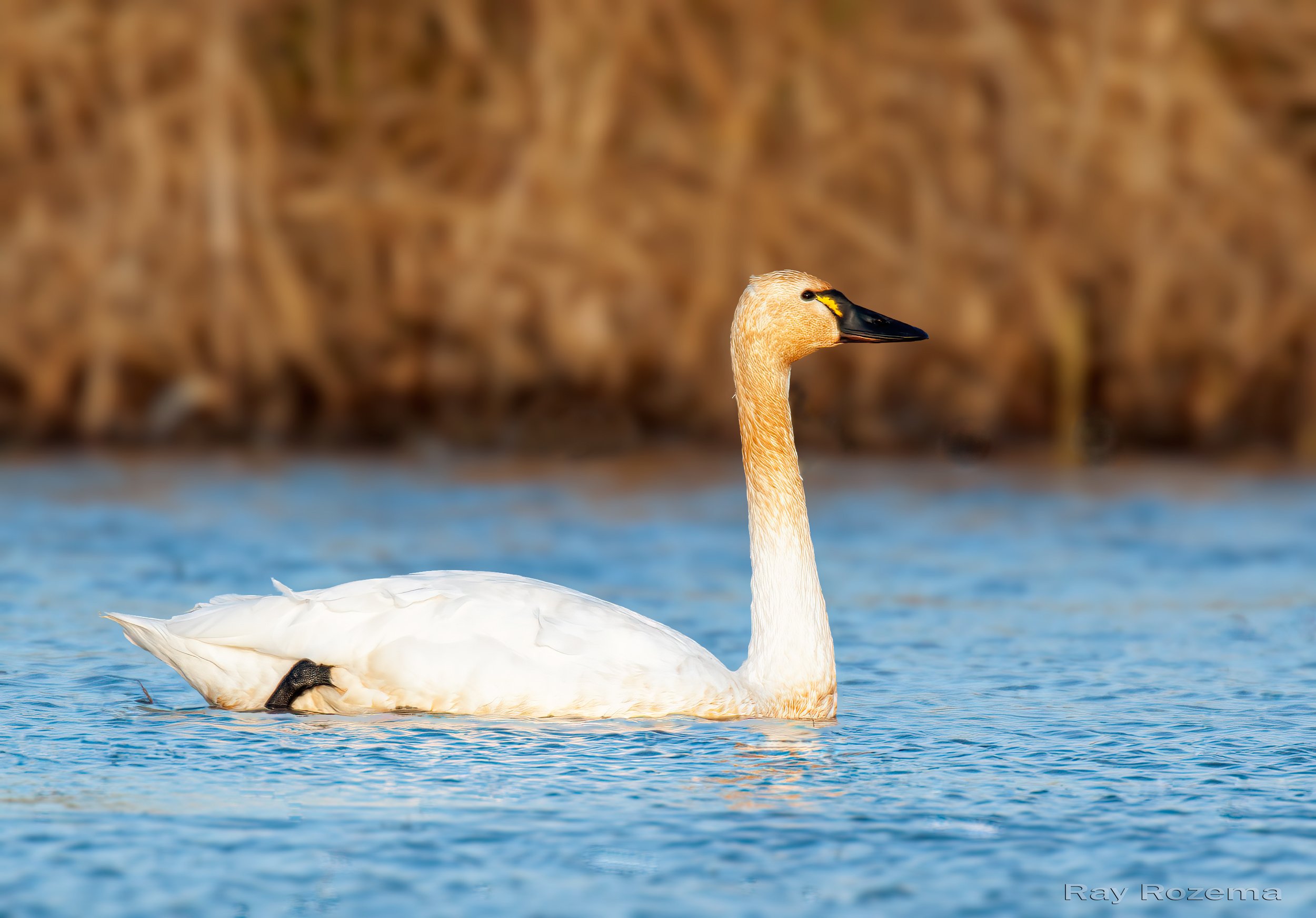
Tundra Swans, Image by Daniel Brown

Tundra Swans, Image by Daniel Lee Brown

Staten Island is another excellent site for viewing large numbers of Sandhill Cranes (as is Cosumnes River Preserve), geese, Tundra Swans, other waterfowl, and shorebirds. In spring and summer, the weedy patches can host Blue Grosbeaks. eBird Sightings

Directions: To reach Staten Island, take Interstate 5 south from Sacramento for 24 miles to the Walnut Grove/Thornton exit. Head west for 3.8 miles on Walnut Grove Road. Shortly after passing Wimpy’s Marina and crossing the Mokelumne River, turn left on N. Staten Island Road. You can drive slowly south and stop to bird until you reach signs indicating the end of public access. As the property is a working agricultural operation, be mindful and respectful of farming and other vehicles.


Woodbridge Wilderness Area (formerly Woodbridge Regional Park)

Brown Creeper, Image by Chris Conard

Brown Creeper, Image by Chris Conard

This park consists of lush riparian woodlands nestled along the south bank of the Mokelumne River in the town of Woodbridge. The canopy is comprised largely of cottonwoods and live oaks. Willows and buckeye are also widespread. The understory includes blackberry brambles and poison oak in many places. Stinging nettle is plentiful also.

Birding the site: The entry is lined with pyracantha bushes, so be sure to check for possible Hermit and Varied Thrushes and Fox, Lincoln's, White-crowned and Golden-crowned Sparrows in winter. At the end of these bushes, the park opens up into a fairly wild area. All trails from this point are hard packed dirt which may be muddy in wet weather or impassable during high water. From here, you will see two trail signs in front of you on the left. These trails meander through the woods and eventually meet at an old fence which is the actual park boundary. If you choose to explore this end of the park, give yourself a minimum of two hours, preferably more.

For a much shorter hike, less than an hour, take the unsigned trail that dives into the woods to your right just beyond the first sign pointing to the trail to the left. Or, if you continue straight ahead from the park entrance, you will end up at the river. Any of these choices can yield good birds, depending on the season.

Year-round residents typical of riparian woodlands that can usually be expected include Wood Duck, Common Merganser, Cooper's Hawk, Red-shouldered Hawk, Great Horned Owl, Acorn Woodpecker, Nuttall's Woodpecker, Downy Woodpecker, Belted Kingfisher, Bewick's Wren, Spotted Towhee, Lesser Goldfinch and American Goldfinch.

During summer months, you may find Swainson's Hawk, Western Wood­ Pewee, Ash-throated Flycatcher, Northern Rough-winged Swallow, Black-headed Grosbeak, Lazuli Bunting and Bullock's Oriole. Birding this area in winter may turn up Red-breasted Sapsucker, Hutton's Vireo, Red-breasted Nuthatch, Brown Creeper, Winter Wren, and Golden­-crowned Kinglet …. in addition to the usual winter warblers, Purple Finch, and Pine Siskin. Spring and fall migration can produce Olive-sided Flycatcher, Willow Flycatcher, Pacific-slope Flycatcher, Cassin's Vireo, Warbling Vireo, Blue-gray Gnatcatcher, Swainson's Thrush, Western Tanager, and all western migrant warblers. eBird Sightings

Directions: From Sacramento, take Interstate 5 for 27 miles south of Highway 50. Exit at Peltier Road and turn left. After 3.8 miles, turn right on North Davis Road. In 2.0 miles, turn left on West Woodbridge Road. In 1.2 miles, turn left on Meadowlark Drive and park along the short street where it ends at River Meadows Drive. The inconspicuous park entrance will be in front of you. This San Joaquin County park is not open daily and has variable hours. To ensure access, visit the San Joaquin County Parks website. Local residents of the park have concerns about vandalism and fire, so please be on your best behavior and respect the rights of the residents. There are no toilets in the park. Poison oak is common. Remember that if you proceed beyond the fence on the north end of the park, you are leaving the actual park premises.

 Jim Rowoth

From Birding In and Around San Joaquin County (2002), courtesy of Jim Rowoth and the San Joaquin Audubon Society.


Lodi Lake

Black-chinned Hummingbirds arrive at Lodi Lake in the Spring. Image by Ray Rozema

Black-chinned Hummingbirds arrive at Lodi Lake in the Spring. Image by Ray Rozema

Lodi Lake Park is truly one of the premier birding areas in San Joaquin County. This reputation is well deserved as over 200 species (over 50% of the county's total bird list) have been observed within the boundaries of this 125-acre jewel along the Mokelumne River in north Lodi. Good safety and maintenance, and easy access and observation all help to give the park year-round appeal.

Birding the site: Lodi Lake Park attracts primarily riparian and open woodland birds. Despite the presence of the Mokelumne River and the lake, there are no true wetlands within the park. Bird groups such as waterfowl, divers, shorebirds, terns and rails are not to be expected in any kind of numbers either as residents or migrants. However, there are enough marginal wetlands present so that with the rich riparian woodland present, one can almost expect any bird found within the Central Valley at the proper season.

The mature trees and lawn area at the park entrance and along Laurel Avenue attract a wide variety of birds all year long. Residents include Mourning Dove, Anna's Hummingbird, Nuttall's and Downy Woodpeckers; Black Phoebe, California Scrub-Jay, Oak Titmouse, Bushtit, White-breasted Nuthatch, Brewer's Blackbird, House Finch, and both Lesser and American Goldfinches. During both periods of migration, nearly every species of warbler can be found, including Orange-crowned, Nashville, Yellow, Black-throated Gray, Townsend's, Hermit, and Wilson's. Other migrants to be expected include Warbling Vireo, Western Tanager, and Black-headed Grosbeak. Spring arrivals that stay to nest in this area include Black-chinned Hummingbird; Barn, Northern Rough-winged, and Tree Swallows, Ash­-throated Flycatcher, and Bullock's Oriole. Birds that arrive in fall that spend the winter include Red-breasted Nuthatch (rare), Cedar Waxwing, Ruby-crowned Kinglet, Yellow-rumped Warbler, and both White-crowned and Golden-crowned Sparrows.

The diversity on or on the perimeter of the lake can be quite high, especially Fall through Spring. One can expect Double-crested Cormorant, Great Blue Heron, Great Egret, Snowy Egret, Killdeer, Pied-billed Grebe, and California and Ring-billed Gulls. eBird Sightings

The highlight of the park is the Nature Area on the eastern side of the park. As one walks toward this area, there is a picnic site on the left that is surrounded by a wall of cottonwoods on one side and a thick row of blackberry brambles on another. The picnic area serves as a good introduction to the Nature Area since the birds, both in numbers and diversity, become instantly apparent here. The entire footpath in the Nature Area has a series of markers numbered 1 through 23. While birds can be seen at any given point within the Nature Area, there are several spots that tend to be more productive than others, particularly numbers 3, 4, 7, 8, 9, 13, 14, 15 and 18.

In addition to all of the woodland birds mentioned earlier, the following can also be expected. Residents include Red-shouldered and Cooper's Hawks, Great Horned Owl, Belted Kingfisher; Bewick's and House Wrens, Hutton's Vireo, Common Yellowthroat, Spotted Towhee, Song Sparrow, and Red-winged Blackbird. California Quail and Wrentit used to be resident, but that status appears to now be in question. However, both can still be seen or heard on occasion. During periods of migration, the entire area can become alive with migrants. In addition to the previously mentioned warblers, MacGillivray's Warbler and Yellow-breasted Chat can be found. Flycatchers can abound, including Olive-sided (rare), Western Wood-Pewee, Willow, Hammond's, Dusky (rare), Pacific-slope, and Western Kingbird. Other goodies to be expected are Vaux's Swift, Rufous Hummingbird, Blue-gray Gnatcatcher, Swainson's Thrush (regular in spring, very rare in fall), Cassin's Vireo, Lazuli Bunting, Chipping Sparrow, and Hooded Oriole. Birds that appear in the fall and often remain through the winter include Pacific Wren (rare), Golden-crowned Kinglet; Hermit and Varied Thrushes; Fox, Lincoln's and White-throated Sparrows (rare), Purple Finch (rare) and Pine Siskin. eBird Sightings

Pig's Lake, at the east end of the Nature Area, is one of the best spots to observe the beautiful Wood Duck up close, particularly during fall and winter. Other species that can be observed at the pond include Green Heron, Great Egret, and Great Blue Heron. About one-half of the turtles at Pig's Lake are western pond turtles (native) and one-half are red-eared slider (introduced).

The park is open to the public every day of the year. The general use area around the lake is not enclosed. The Nature Area has a series of trails throughout with at least one paved path. This area is enclosed by a fence and is usually opened at sunrise and closed at sunset. Watch out for poison oak on some of the side trails. Public restroom stalls are available in the general use area. The topography of the park is totally flat. The dirt paths in the Nature Area are very well maintained, allowing safe passage during the entire year for people of all ages and abilities.

Directions: Lodi Lake Park is on the north side of Turner Road in north Lodi. From Sacramento, take Interstate 5 for 30 miles south of Highway 50. Exit at Turner Road and head east for 5.8 miles and turn left on Laurel Avenue. From Highway 99, drive west on Turner Road for 1.6 miles and turn right on Laurel Ave. There is no fee to enter the park, but there is a parking fee. Most birders traditionally park on West Turner Road, immediately east of the park entrance, and walk in.

 David Yee

From Birding In and Around San Joaquin County (2002), courtesy of David Yee and San Joaquin Audubon Society. Updated April 2021.

Western Kingbird, Image by Daniel Brown

Western Kingbird, Image by Daniel Lee Brown


Solano County

In August of 2020, a megafire called the LNU Lightning Complex became the biggest fire of the Coast Range. It devastated the hills and canyons of the Vaca Mountains and left behind charred forests, chaparral, homes and ranches.

Locations recommended in Solano County such as the Lake Solano Park and UC Davis - Stebbins Cold Canyon Reserve and surrounding areas up to and beyond the Monticello Dam were hard hit. Although the natural beauty of this area has been substantially altered, these sites are open once again to the public.    

Lake Solano Park 

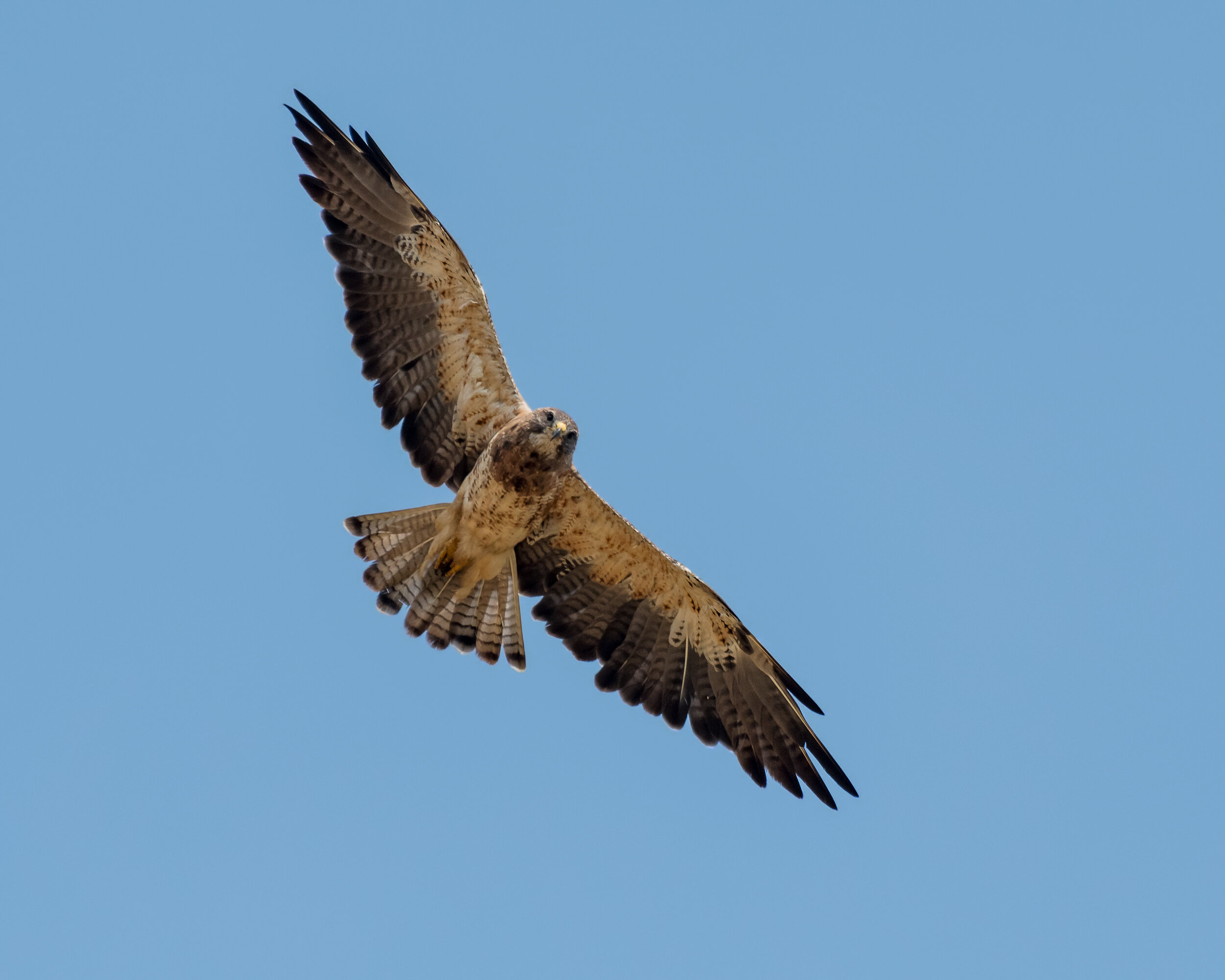
Swainson’s Hawk, Image by Daniel Lee Brown

This magnet for birds on the Solano-Yolo County line is formed by a small diversion dam on Putah Creek several miles east of Lake Berryessa and the Vaca Mountains, the eastern-most ridge of the North Coast Ranges. There are several productive areas to bird including the Lake Solano Park campground and day-use area on the west end and the wide, open water along Putah Creek Road at the eastern end of the Lake near the dam. Riparian habitat, adjacent farmland, open fields, and the lake and Putah Creek provide attractive habitat for a wide variety of bird species. For best birding, visit the area early in the morning; fall and winter are most productive, due to the arrival of winter visitors.

Birding the site: On the drive to the Lake, check the orchards for mixed flocks gleaning remnants of the walnut harvest including large flocks of Wild Turkey. In spring and summer, along Covell Boulevard, look for Swainson's Hawks which often feed in the open fields as well as other birds of prey. Check American Robin flocks for a possible Varied Thrush.

As you approach the Lake, there is a small parking lot on the left at the dam, but as this lot is posted “No Parking,” continue a bit further west until you reach a larger parking lot at the base of a long line of cliffs on the left. Check the cliffs for Great Horned Owls roosting in some of the caves and the brushy cliff-sides for Wrentits, year-round, and Hermit Thrush in winter.

The lake provides habitat for numerous migrating wading birds and waterfowl. In winter, this is one of the best places for Hooded Mergansers and Osprey. Check the far shoreline for shorebirds, and the near shoreline for wrens, towhees and sparrows. Watch for river otters which are fairly common. Osprey and Phainopepla may be present in the trees across the river as well as Lewis’s Woodpeckers and an occasional Bald Eagle in winter. It is easy to spend an hour or more here depending on the bird population on the lake. A scope is very helpful.

Leave the parking area and drive west about one mile and turn right onto Pleasants Valley Road. Drive three-quarters of a mile to the park entrance. There is a parking lot on the right with a day use parking fee of $6 - $8, depending on the season. This is a good spot for lunch with picnic tables, restrooms, and big deciduous trees providing shade in the summer. If you missed the Hooded Mergansers at your first stop, they can often be found here with occasional large numbers of Goldeneyes and Buffleheads. This is also a nice spot for a short walk along the creek with good birding including a possible Red-breasted Sapsucker, Phainopeplas, and a Pileated Woodpecker. Check eBird Sightings for recent reports. The park is generally crowded late spring to early fall.

You can walk across the road to the campground, and a stroll through these sites may also be productive. Vegetation is denser, and warblers, vireos and other songbirds may be found here during migration. Brown Creepers are often found here in winter, and Hermit Thrush numbers can be astounding.

Directions: From Sacramento, take Interstate 80 west (about 14.5 miles west of Interstate 5) and go north on Highway 113. In 2.8 miles, exit at Covell Boulevard, turning left over the freeway. Continue west for 12 miles to Winters, crossing over the 505 freeway, where the road becomes Highway 128. Turn left onto Railroad Avenue, cross the bridge over Putah Creek and turn right onto Putah Creek Road. Continue west on Putah Creek Road, which roughly follows Putah Creek through farmland and orchards. It is 3.8 miles from the bridge to the large parking area at Lake Solano. 

To reach Lake Solano Park, continue on Putah Creek Road to Pleasants Valley Road. Turn right and go 0.8 mile to the park entrance on your right. This is a fee area, and rangers are enthusiastic about giving tickets to those who do not pay. Also, do not park at the campground unless you are intending to camp, since the staff there is extremely vigilant.

For current hours and conditions at the Lake Solano Regional Park visit the Solano County website.

June C. Persson and Maureen Geiger


UC Davis – Stebbins Cold Canyon Reserve

Mountain Quail, Image by Daniel Lee Brown

The Stebbins Cold Canyon Reserve was dramatically altered by the 2020 megafire. Small areas of the inner Canyon are coming back, and there are signs that it will once again be the beautiful birding area it was prior to the fire.

In the past, the predominantly chapparal habitat drew some bird species unique to the Sacramento checklist area. The canyon itself is densely vegetated, and the predominant species are typical of riparian oak and scrub woodland including interior, live and blue oaks, buckeyes, chamise, cottonwoods, coyote brush, manzanita and toyons. The canyon is a wonderland of wildflowers in April and May. Near the top is a blend zone of coastal and valley vegetation. The reserve is owned and managed by the University of California at Davis as a research area and is currently open to the public from sunrise to sunset. Visitors are asked to stay on the trails; abuse could cause closure—as an incentive to stay on the trail, deer ticks and poison oak are common, as are Pacific rattlesnakes, especially near the Homestead and on the upper ridgeline.

Birding the site: As you approach the mountains on Highway 128, check the skies above for hawks, falcons, and possibly a Golden Eagle and the fields and fences for Western Bluebirds. In spring, the fields are covered with flowers, mainly lupine and California poppies. The valley oaks here are always a treat.

As you begin your hike, continue straight ahead approximately 100 yards to the entry of the Stebbins Preserve. There is a large kiosk and map of the area as well as trail guides. Be sure to follow all the posted rules. The trail parallels and soon crosses Cold Creek. The creek is not perennial so the only times you may have trouble crossing are in wet winters or springs when water is rushing toward Putah Creek. Continue up canyon, and the trail will open to a grassy clearing with wonderful views of the coastal mountains on both sides. Along the upper end of the trail, pay close attention for the calls of Mountain Quail. Just past the clearing is a densely shaded area called the Homestead where remnants of an early dwelling can be found. The trail for our purposes ends in these trees. Above this is private property.

Any season can be rewarding. The best time to visit is early in the morning as even in the spring and fall, this canyon can be hot. The trail is moderately steep and rocky in many places and may not be suitable for some birders with disabilities.

Resident species include Cooper's and Red-tailed Hawks, Golden Eagles, Mountain Quail, Western Screech-Owls, Great Horned Owls, Northern Pygmy-Owls, White-throated Swifts, Anna's Hummingbirds, Nuttall's Woodpeckers, Black Phoebes, Western Scrub-Jay and Steller’s Jays, Oak Titmice, Bushtits, Bewick's Wrens, Rock and Canyon Wrens (near the creek), Blue-gray Gnatcatchers, Wrentits (their ping pong call often heard), California Thrashers (usually singing), Hutton’s Vireo, California and Spotted Towhees, Rufous-crowned and Bell’s Sparrows.

In summer, expect Black-headed Grosbeaks, Lazuli Buntings, Common Poorwills (before daybreak), Bullock's Orioles and several species of swallows.

In winter, expect Sharp-shinned Hawks, Varied Thrushes, and crowned sparrows. Long-eared Owls and Northern Saw-whet Owls have been recorded. Spring is one of the best times, and you can expect flycatchers, hummingbirds, warblers, vireos and Western Tanagers along with the year-round residents. eBird Sightings

Whether or not you hike up the canyon, a great place for a picnic lunch is below the dam. After crossing Putah Creek on Highway 128 coming from the east, drive into the lower parking lot and walk toward Putah Creek. This is a good spot to listen for Canyon Wrens across the creek and for occasional Rock Wrens. Rufous-crowned Sparrows have also been found in this location.

Northern Pygmy Owl, Image by Daniel Lee Brown

Also keep your eyes open for a Northern Pygmy-Owl which frequents the south side of the creek close to the dam. A great time to see this bird is in the winter when the leaves are off the trees. Once a Pygmy-Owl entertained a group from Sacramento Audubon sitting only 20 feet away on an open branch, ignoring its observers, then plunging into the grass below and coming up with a mouse! The mouse was almost as big as the owl!

An American Dipper may be found sporadically in winter on Putah Creek from the dam to downstream of the Highway 128 bridge—often just below the bridge.

As you leave the parking area, drive around the curve west on Highway 128 to the top of the dam for a view of Lake Berryessa. Watch for Western and Clark's Grebes on the lake and look overhead for White-throated Swifts, Turkey Vultures, hawks, falcons, and a possible Golden Eagle.

Directions: From Sacramento, take Interstate 80 west (about 14.5 miles west of Interstate 5) and go north on Highway 113. In 2.8 miles, exit at Covell Boulevard, turning left over the freeway. Continue west for 12 miles to Winters, crossing over the 505 freeway, where the road becomes Highway 128. Stay on this road as you go through the town. Where it intersects with Pleasants Valley Road, it is 4.7 miles to the bridge over Putah Creek at the base of Monticello Dam. Along the way, the creek will be on your left with many good spots for a few moments to check the riparian habitat.

Just past this bridge and below the dam, there is a large dirt parking lot on the right. There is a small parking lot immediately across the road from this lot which is also open to the public. Reaching the entrance involves a dangerous pedestrian crossing as it is on a hairpin turn. BE CAREFUL and listen for the traffic!!

For current hours and conditions visit the UC Davis, Stebbins Cold Canyon webpage.

June C. Persson


Robinson Road to Birds Landing

Northern Shrike have been found at Birds Landing, Image by Daniel Brown

Northern Shrike have been found at Birds Landing, Image by Daniel Lee Brown

This area is southwest of Sacramento in Solano County. It is especially good birding in the winter, when raptors can be found among the open grasslands, and clusters of eucalyptus and Osage orange trees. This area can be excellent for wintering Mountain Plovers although they are not consistently reliable, and for Loggerhead Shrikes year-round. Traffic is sparse along these quiet dirt roads, which helps make birding pleasant and rewarding. The best times to bird are from October to February, although at times it can be foggy.

Birding the site: Ferruginous Hawks, Rough-legged Hawks, Northern Harriers, White-tailed Kites and Red-tailed Hawks are quite reliable during the winter, although numbers vary year to year. Bald and Golden Eagles are occasionally found especially around the large power lines also frequented by Prairie Falcons. Watch the fields for large flocks of Horned Larks, Long-billed Curlews and American Pipits. Other species found in this area are Say’s Phoebes, Western Bluebirds and Savannah Sparrows. In several recent years, Mountain Bluebirds have also been found. Watch the ponds for wintering waterfowl and geese. Major highlights in this area have been Gyrfalcon and Northern Shrike. Look for Tri-colored Blackbirds in winter flocks in the Birds Landing area. eBird Sightings

Directions: Take Interstate 80 about 19 miles east of Sacramento to the Highway 113 South exit in Dixon. Go south through Dixon for 17 miles to Robinson Road. Drive Robinson Road and explore the many country roads: Creed Road, Goosehaven Road, Flannery Road and McCormack Road. Continue south across Highway 12 and take Birds Landing Road to Shiloh Road.

Tim Fitzer and Maureen Geiger


Lagoon Valley Park

Horned Lark, Image by Craig Swolgaard

Horned Lark, Image by Craig Swolgaard

This park just off of Interstate 80 in Vacaville contains nearly 500 acres. It provides excellent opportunities to find water birds and land birds. The reservoir is always worth checking, and it once produced a Long-tailed Jaeger. The trees can be very good for migrants, and a Northern Waterthrush was found here. Unfortunately, there is a lot  of development pressure on private lands surrounding the park.

Birding the site: After entering the park, go for about 1,000 feet and check the oaks on the left at the picnic area. This is often excellent for migrants. All of the trees are worth checking in migration and winter, since there is usually a flock somewhere in the area. The park road wraps around the east side of the reservoir and heads south. Scan the reservoir from the ample parking areas off of the park road. Depending on the direction of the light, you may want to walk a portion of the trail on the west side of the reservoir. At the south end of the road, there is a small creek with willows. This has also been very productive for songbirds in the trees and shorebirds on the silt bars. The historic Peña Adobe is interesting, and Pileated Woodpeckers have been reported there, as well as excellent numbers of passerines during spring and fall migration along the creek. eBird Sightings

Directions: Take Interstate 80 for about 34 miles west of Interstate 5 in Sacramento. Exit at Peña Adobe. Turn right, over the freeway, at Cherry Glen Road, and into Lagoon Valley Regional Park.